
Melklaan in Velsen-Noord (Wijkeroog)
Locatie in 2025: Google-Maps
De Melklaan was een gewone straat met arbeiderswoningen. Het was de doorgaande straat van de Wijkerstraatweg naar de spoorwegovergang bij de Grote Hout of Koningsweg. De Melklaan en de straten in de omgeving zijn in de oorlog gesloopt om schootsveld te creëren. De nieuwe loop van de straat begint nog op dezelfde plek waar de Melklaan op de Wijkerstraatweg uitkomt, maar loopt nu noordelijker.Het tracé in 1921 komt uit waar nu het Stratingsplantsoen eindigt. [Bron: Historische Kring Velsen(The Melklaan was an ordinary street with working-class houses. It served as the main thoroughfare from the Wijkerstraatweg to the railway crossing at the Grote Hout or Koningsweg. During the war, the Melklaan and the surrounding streets were demolished to create a clear line of fire. The street’s new route still begins at the same point where the Melklaan met the Wijkerstraatweg, but it now runs further north. The 1921 layout ended where the Stratingsplantsoen now terminates." [Source: Historische Kring Velsen, topotijdreis.nl])
.....
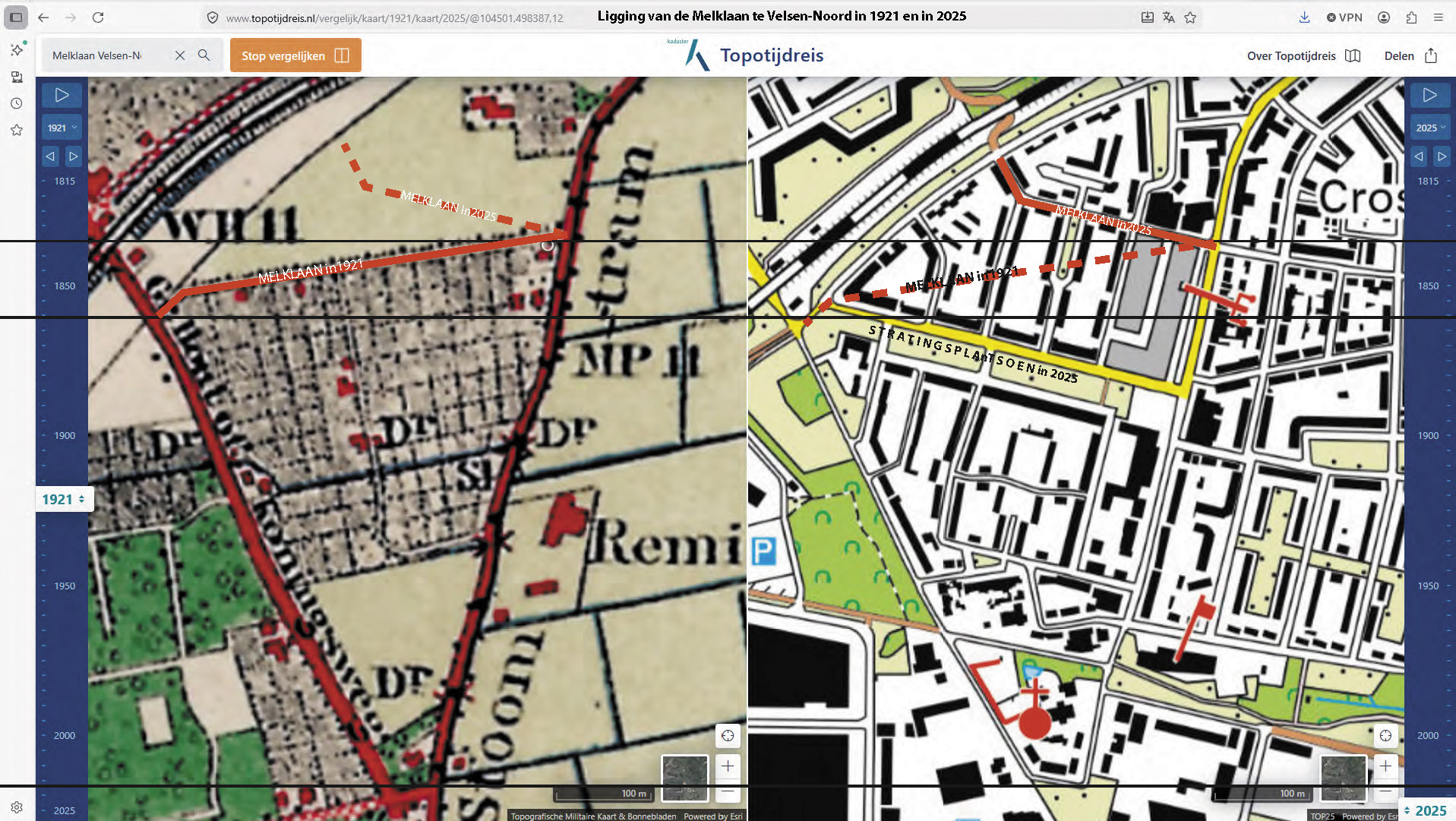
Het tracé van de Melklaan in 1921 vergeleken met de situatie in 2025→
(Mapping the Melklaan: 1921 vs. 2025.)
Locatie en bijzonderheden (location and particulars)
Wie woonde hier...? (who lived here ...?)
- op nummer 102: ►het gezin (the family) Duijn - Nak→ tot (until) 1926